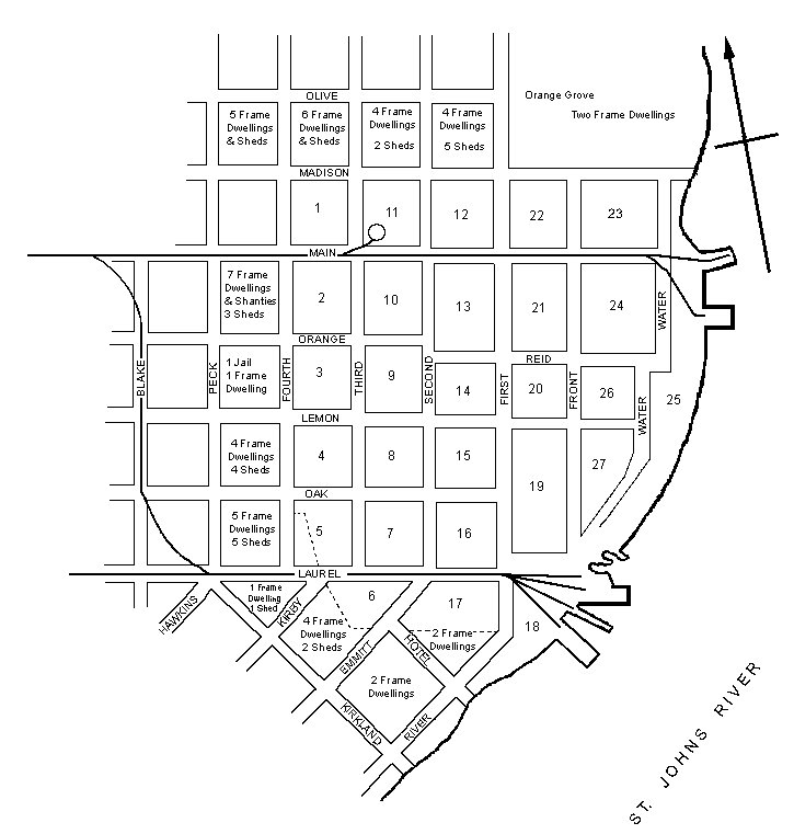
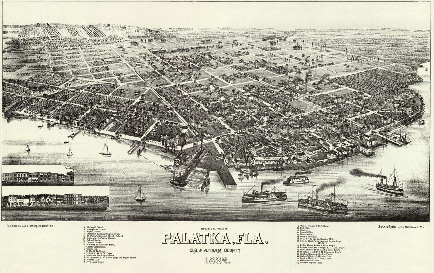
The map to the right is based upon the April, 1885 fire insurance map published by the Sanborn Map and Publishing Company. Additional information was acquired from the 1885 State of Florida Census, Webb's 1886 Palatka City Directory, and the 1884 lithograph of the Bird's Eye View of Palatka by Beck and Pauli published by J. J. Stoner. The 1885 fire insurance map is limited to the downtown section of Palatka bounded by Madison Street to the north, Fourth Street to the west, the St. Johns River to the east, and Laurel and Hotel Streets to the south.
Throughout the 1880s Palatka was experiencing tremendous economic and population growth. Because of the limitations of the 1885 map the growth of residential areas to the north (Reid's Garden), west (Newtown--a largely African-American section), and southwest (the Hammock or the West End, and the newly-incorporated municipality of Palatka Heights) are poorly represented. Not until 1897 did the Sanborn Company expand coverage to capture some of these areas on the map of Palatka. Sanborn maps for the city of Palatka were made in the following years: 1885, 1887, 1892, 1897, 1903, 1909, 1915, 1924, and 1930. The 1930 map was updated until the 1950s with paste-on overlays.
Two notes about street names and numbers. First, in the early 1900s the north-south streets were renumbered with the names of Water and Front Street being changed to First and Second Street. As a result, the numeric designation of the streets west of these were increased by two so that the First Street of 1885 is today's Third Street, and so forth. Secondly, while the maps provides individual house or lot numbers these are arbitrary and do not correspond to those assigned today. Actual lot numbers began appearing on the Sanborn maps in the early 1900s.
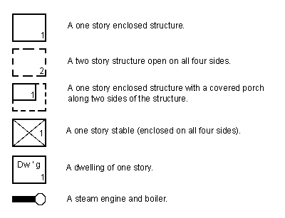
The original maps used color to denote whether a structure was wooden frame, brick, etc. The source for the map below lacked that information. Most buildings in Palatka were wooden frame so unless otherwise stated herein it is safe to assume any particular building was made of wood.